Day 16 – Part 2, Ridgetown, Ontario, Canada

Black squirrels are common in Michigan and Ontario.

Only 39.07 miles today, into constant headwinds. The night before I consulted on Google maps about hotels in Ridgetown. It showed just one, The Ridgetown Inn. I made that an intermediate goal for the day, should I not be able to make it to a further destination, such as Port Stanley.

The day was decent, some sun, billowy clouds here and there, and flat roads, perfect for bicycling. There is one exception, as you’ve no doubt guessed: wind. The wind was out of the east and terrible. I was going east so I struggled through a headwind. It was like riding uphill all day. At least a hill goes down once in a while, you get back you kinetic energy that you have stored.

The wind generators all over the landscape were whirling away.

They also have lots of solar panels in the region, but they have sensors on them that move them horizontally when the winds get too high, to prevent wind damage. I don’t know at what point they go horizontal, but they were all up. One report showed winds of 23, with gusts of 30 MPH (40-50 km/h). It was a serious struggle to make it to Ridgetown.

Plum tomato harvesting in Ontario.

For many crops, it is harvest time. There were miles and miles of tomatoes being harvested, all by machine. Plum tomatoes are reasonably tough and can be machine harvested.

Plum tomatoes ready for processing. I saw many loads of these. Somebody is going to make spaghetti.

I can’t imagine how many tons of tomatoes were on their way to be made into sauce. Truckload after truckload passed me.

Politicians in Florida are in the pockets of the fossil fuel energy companies. They grandstand on the legislative floors and make speeches about Florida not having enough sunlight to make solar power viable. Think about that, our license plates say “Sunshine State.”

Everywhere I go up here in the north I see prime examples of using solar energy to solve problems. In the photo above, an agricultural industry by the name of Green Hill has indoor plant growing areas. They’re surrounded by solar panels and wind generators. They’re growing tomatoes, peppers etc. in an area that has severe winters. They’re slogans reflect a locally grown mentality. This is a huge operation, not some backyard industry. Gotta love Florida politicians.

Arriving in Ridgetown I couldn’t find the hotel. I asked a young man walking down the street and he said he didn’t know where they were, but he did see one by the highway. My search earlier had shown only one in town, so that had to be it. It was 3.6 miles (6 km) away. I was already beat, but what could I do?

After riding to the motel, I was able to get a room. The place looked deserted. There had to be fifty rooms and I was the only one there. The manager, the only staff I ever did see, put me in the same room that James, the fellow on the recumbent, had stayed in the night before. He was probably in Massachusetts by now, or Europe.

I rested for a bit and then went to the hotel restaurant, noticing that the indoor pool had no water in it. The restaurant was locked up tightly, with no sign that it wasn’t in business. Tables were set, everything looked ready, but the lights were off and there was nobody home. The manager yelled up to me that the restaurant was out of business. He has a grasp of the obvious.

He pointed up the road further to a gas station and indicated they have a restaurant. I walked up there and they indeed did have a dining establishment. It wasn’t a terribly appealing place, but I was now hungry. I ordered the meatloaf plate.

I should have taken a photo. The meatloaf was fine, but the baked potato was smaller than the small container of sour cream that came with it. I’ve been riding by fields of potatoes for weeks and this is the best that they can do. Recall my adventures in Idaho where I couldn’t find a baked potato anywhere. Well, I did find one in Ontario, but it was barely visible.

Returning to the room, I went to take a shower. The manager cautioned me that the hot water takes a while to get warm. He wasn’t kidding. I turned on the water and started reading a book on my Kindle Reader. I think I read ten pages before the water was hot. They must have a pipe that comes from the Icelandic steam beds.

At last, it was time for bed. I slept like a baby. I guess exercising all day will do that.

Day 24/25: Powell, Idaho to Lolo, Montana

20160805_102820
Mr. Moose goes for a dip.

Another state, another timezone. I’m finally in the Mountain Time Zone, only two hours from my timezone in Florida. Only 11 miles to Missoula, Montana.

Upon leaving Powell, Idaho I encountered numerous deer. Then I spied this male moose off to my right. The photo doesn’t do it justice, he was much closer than it appears. He kept looking up at me on the road and then decided to wade out into the pond.

He had a ball. He kept splashing his head in the water and making big waves and then would just watch them. Every so often he would look up to make certain of my whereabouts and then do more splashing. He was fun to watch and I spent about twenty minutes there. He was like a big kid with his own kiddie pool.

Today I was facing a climb over Lolo Pass, 5235 feet (1595 m), which would bring me into Montana. I was anxious to see a new state, one I had not been to before.

The climb was a few thousand feet, but the road was gradual enough that it wasn’t a killer and I was feeling good at the pass. Idaho has a visitor center there and I filled up my water bottles and rested for a bit. I tried to call Jane using Skype, but, as usual, the WiFi was powered by potato (see previous comments in another post) and we were only getting about every third word of the conversation.

Just beyond the center was the sign for Montana. I ran into David there, he is a retired police officer following the path of a book he read recently about an attempted murder case. The book, A Strange Piece of Paradise, is about two women cyclists that rode cross country and were attacked in Oregon. A man ran over their tent with his pickup truck and then proceeded to attack them with an ax. Amazingly, they both lived.

20160805_152353

David was riding an Indian motorcycle. It was an impressive machine and it was nice talking to him. We parted ways and I was in Montana.

20160804_111628
They have finally named a creek after me, how nice.
20160805_175513
The cows always view me with suspicion.

In late afternoon, I arrived in Lola, Montana. I tried to hook up with someone from the WarmShowers.org, but it was late in the day and I gave up. I had a quick meal in Lolo and then pedaled back to a campground that I had passed earlier, 2.5 miles (4 km) out of town. The campground, Square Dance Center and Campground was full. It was getting dark and even though they had a dance in full swing, the owner took me out to show me where I could put a tent and find a shower. I’m forever grateful. Additionally, the campground has the best WiFi service I’ve seen since leaving the Pacific Coast! Kudos.

As I was signing in they offered for me to join in the dance. There were at least a hundred people dancing and they have never seen me dance. It would have been like rolling a giant bowling ball into the middle of them. It would have been chaos. I can’t dance a step, just ask Jane.

The campground is very nice and I felt quite at home with everyone I met. I liked it so much, I decided to spend the next day there before heading off to Missoula, Montana.

Day 23: Lowell, Idaho to Powell, Idaho

I stayed in the motel unit in Lowell, Idaho, because there was talk of temperatures near freezing, but it didn’t get quite that cold. It was cold enough in for the morning departure that I did wear all my heavy clothing and I didn’t regret having the motel room. The WiFi there was useless, but that was becoming the norm.

Keep in mind that most of the places I’ve mentioned in Idaho are very small towns, if a town at all. Lowell had a sign in front of the cafe that showed a population of 24 that was scratched out and 23 written over it. I was afraid to ask what happened to #24.

20160804_080657
Population change in Lowell, Idaho.

My destination for the day was Powell, Idaho, 66 miles away. There would be no cafe stops or stores along the way, it is all wilderness. The road follows a river upstream, which to a bicyclist, means an uphill ride all day. It wasn’t a big climb, but it is a constant uphill with no break. The total climb for the day was 1944 feet (592 m).

My plan was to ride the entire distance. The fall-back plan was, if I tired, to camp somewhere along the way. The road, which is also the path that Lewis and Clark took on their expedition, runs through the Bitterroot Wilderness and is stunningly beautiful.

Lewis and Clark sign.
The Lewis and Clark Expedition, in 1804-05, passed through this same trail, both on the way west and the return to the east.

One advantage to riding a bicycle is the animal life doesn’t hear you approaching so there are many opportunities to observe deer, badgers, moose, Colombian ground squirrels and other natives of the area. I hoped to see a Canadian Lynx, they’re endangered, but failed to do so.

The route, for most of the day, was a bit monotonous: pedal up grade, turn corner, take in breathtaking beauty, repeat.

20160804_104502
66 Miles of beauty, fish, moose, deer and outdoor life.

It wasn’t all lonesome. Along the way I would chat with people pulled over at the numerous “turn-offs,” as they call them here. See photo above. Fly fishing seemed to be the main event of the day and I saw dozens of people trying there hand at it, although, I don’t recall anyone with a fish.

Most of the bicycle traffic I have been seeing over the weeks has been headed west. Today, Wendy, and east-bound rider, passed me and accelerated away. Ah youth, to be young again. I would see her later at the campground.

I arrived in Powell late in the day. Actually, I arrived at where Powell is on the map. As near as I could tell there isn’t actually a town of “Powell.” There is a popular vacation lodge there which hosts cabins, campsites for bicyclists and a very nice restaurant. After a long day without a real meal, I was ready.

As I rode down the dirt road into the cabin area I came up behind a tanker truck spraying water on the road to keep the dust down. It was only moving about a walking pace so I kept my distance behind it to avoid getting wet. I spotted a nice group of folks sitting out in front of their cabin and pulled over to ask how far it was to the restaurant.

With all the noise of the truck spraying, and the people yelling instructions to me, a dog that was sitting on one of the people’s laps decided she had had enough and sprung loose from her leash and charged at me and sunk her teeth into my foot, which was still clipped to the bike pedal.

It all happened so fast that it really didn’t register at first, then I felt my toes being squeezed. Even though I was wearing sandals, it did get my attention. I lifted my foot and the poor animal went flying, maybe six or seven feet.

I’m certain the owner was horrified to see her black schnauzer sailing through the air, but I was relieved to know that my foot was fine. Surprised, the dog limped off back to her owner. There was a second dog there, but he was big and didn’t seem in the least bit interested. Thank goodness.

Starving as I was I didn’t give much thought to the incident and got instructions to the restaurant. After a monstrous turkey club sandwich, with salad, I returned to put up my tent and check on the dog. I really didn’t want to hurt her, being a dog lover.

The group greeted me and the dog, Sophie, kept a wary eye on me. The other dog, a big friendly thing, became my immediate friend. Sophie and I kept an uneasy truce and all was well. She wasn’t hurt, other than perhaps her dignity. They were a nice bunch of folks and invited me for a drink, but I figured I would pass out if I had anything. All I wanted to do was put up the tent, shower and get to sleep. Hopefully, someone in the group will send me a nice photo of Sophie.


Bike camping at the Lochsa Lodge is free for bicyclists and of course use of the bathroom facilities. The lawns are lush and green and a welcome sight at the end of long day. The showers are $5.00 and well worth it. They supply you with a towel, shampoo, soap and a very nice private shower room. I highly recommend this place. They are open year round and the restaurant is exceptional. Try the Moose Drool beer. Additionally, they have a very well stocked camp store.

Watch for a little black schnauzer on the way there, she has an odd way of greeting you.

Day 22: Grangeville, Idaho to Lowell, Idaho

I Started out early from Grangeville. Prior to leaving, I sat on the steps outside the motel office to call Jane. I had to sit there because the WiFi service was terrible and that was the only place I could get a signal.

While talking to her, dogs started showing up. All sorts of dogs. Big ones, little ones, and all sorts of colors and breeds. Before I knew it, I had five dogs surrounding me, all wanting for attention. Everybody wanted an ear scratched or a belly rub. It was crazy. My next door neighbor, Elizabeth, who works with rescue dogs would be thrilled, especially since the leader of the pack seemed to be a little white dog.

Riding east from Grangeville I was looking across huge fields of oats or wheat. I stopped to photograph some combines harvesting the crops and even took a video. I figured my grandson, Ronan, might get a kick out of the combines since there is a scene in the Pixar movie Cars where a combine gives chase to the protagonist in the film, “Lighting McQueen.”

The terrain was mostly flat with an occasional 200-foot (70-m) steep climb, just to keep things interesting.

20160803_102215
The wide-open spaces out of Grangeville, Idaho.

Then came the descent down to Stites, Idaho. I don’t have the stats on the descent but it must be several thousand feet over about two miles (3 km). I’m a seasoned mountain bike racer and have no fear of going down a rapid descent, but this was quite another thing. My bike weighs about 30 lbs (13.6 kg) and the gear and panniers add about another forty lbs (17 kg). If you know anything about bicycle brakes, they’re just two little rubber pads on each wheel and are operated by a small cable to each wheel.

20160806_151718
Note Stites, Idaho, at the bottom of that drop on the right.

I was going down grades that would easily allow me to get up to about 60 mph (96 kmh)! I could just envision those little rubber pads turning into molten rubber smudges on my bicycle rims. It wasn’t so much the speed but the fact that there were turns at the end of a steep downhill run that were posted 10 mph (16 kph) turns. Going into a turn such as that with melting brake pads didn’t appeal to me. I stopped at least five times on the way down to cool the brakes. The descent was insane.

20160803_115312
If you miss that turn, it is a long way to the bottom.

At the local pizza place in the town at the bottom, Stites, I asked if they ever have any problems with people losing their brakes on the ride into town. The gal behind the bar didn’t recall any. I was amazed.

I ordered a rather nice pizza and couldn’t eat but half of it. I asked if she knew anyone that couldn’t afford a pizza and if she could box it up and give it to them, and she did. I hate to see perfectly good food go to waste. That was nice of her. Score one for the Stites Pizza parlor.

When I arrived in Lowell, Idaho, there was talk of temperatures in the mid 30’s F (2 C) so I wimped out and got a motel room. The thought of a hot shower, warm bed, and the Internet was just too compelling. Of course, as was often the case across Idaho, the Internet connection was a myth. There was hardly any signal in the room. I went sniffing around for the WiFi router and found it at the end of the building. Even standing next to it, with five bars of WiFi signal, the connection speed was abysmal. Smoke signals would have been quicker.

Idaho, being the potato state must be using a copper and zinc rod stuck into a potato to power the WiFi routers, I can’t believe how weak the signals are.

Day 21: White Bird, Idaho to Grangeville, Idaho

20160802_121719
The sign lies; the old route actually goes up higher, maybe another 300-400 feet! Old route takes a right at the sign.

21 Miles. Only 21 miles and I was spent. It all started out well enough. I slept in the White Bird, Idaho, municipal building. I slept until about 04:00 am and then there was a very loud “bang.” I figured somebody was just shooting a rattlesnake somewhere and went back to sleep.

What I didn’t notice was everything was very dark. From the school house, I had seen some street lights when I went to sleep but didn’t pay much attention. The loud “bang” was a pole transformer blowing out. Not long afterwards, a crew showed up to repair things. I awoke to voices and flashlights, very powerful flashlights, shining everywhere. There must have been six or so people working on replacing the damage. It wasn’t an easy task, the pole isn’t on the road and is halfway between the highway above and the main road I was on.

They had to manually lug all that equipment up there to make the repairs. With all the rattlesnakes in the area, that must be a joy. I had considered going up to the local swimming hole before going to sleep but was warned that the area is crawling with rattlers, especially around sunset and I opted to avoid a confrontation.

20160802_071504
The pole that needed repairs, in the dawn light.

Breakfast was not an option. The one cafe that does serve breakfast didn’t open until nine  and the convenience store was not opened on the previous day, so I couldn’t stock up on anything. I set out as the sun was rising, hoping to make it over the pass in good time.

The climb up to White Bird Pass is long, arduous and hot. There is almost no shade at all and the sun just pounds down on anyone exposed to it. I started around sunrise, but by 10 am, it was stifling. I did have a good quantity of Gatorade and water, so at least I had liquids.

In spite of suffering the heat, the views were breathtaking.

20160802_085936
Looking back from whence I had come. This is about a third of the way up the climb.The schoolhouse I started from is in the upper right-hand corner of the photo.
20160802_081037
The road just keeps going up and up. The new modern highway is way off in the distance on the upper-left of the photo. At one point this road joins it for about a mile. Add 100+ degrees F to really enjoy this.

In all, I spent about six hours climbing. I ended walking for about the last 1.5 miles  (2.5 km), it was just too steep in my weakened condition to pedal. The new, modern, highway is an alternative, but it so busy with tractor trailer truck traffic and speeders that this older road is the better alternative. As it is, the old road does join the new highway for about a mile, and it is no joy.

I rolled into Grangeville, Idaho in mid-afternoon and made a beeline for a Mexican restaurant. I still wasn’t that hungry but knew I had to eat. I can recommend the Palenque Mexican Restaurant as an excellent place for a hungry biker. I must have looked a mess, yet they treated me with kindness, caring and lots of cold drinks and the food was very good. I had Arroz con Pollo (Rice with chicken) and finished it all. I ordered from the luncheon menu, hoping for smaller portions, but it was still huge.

I decided, once again, that I just wanted to be indoors tonight and opted for a hotel. I’m going to break the bank, but the heat is killing me.

After a shower and nap, I walked into town for a milkshake, I’ve been yearning one. I had one at a place called Yummies. The fellow that runs the place told me he has been thinking about expanding into something to go along with the ice cream business. I suggested he think about an idea that my father-in-law had, the late Roger Veilleux. Roger was from Maine and thought that a fast-food business based on beans and potatoes would be a winner. I agree. So many people like beans and baked potatoes. The trick would be to come up with a cone-like container for beans and a convenient way for someone to walk away with a ready-to-eat baked potato. Idaho, being the Nation’s potato capital could easily fill that bill. I could see the young man’s gears in his head whirring. If he tries this and succeeds, you heard it here first.

20160802_191224
Grass-fired steam tractor.

One of the great things about hiking and biking, as I’ve mentioned before is getting to see the local towns through a different lens. As I walked around Grangeville this evening, I took in many of the historic markers around town and this tractor caught my eye. It looked big, heavy and powerful and ran on burning dried grass, or wood when they could get it. It was impressive looking and I could just see them out in the fields sweating away, feeding fuel into this monster to keep it running.

Not far from where I am staying there is a museum of Mammoth bones that have been found in the area. This area of the world is known for its mammoth finds. As much as I should spend some time seeing all this, I will head out in the morning. It is essentially a long, gradual climb to Missoula, Montana from here and I could be there in a few more day, it is about 166 miles.

Day 20: New Meadows, Idaho to White Bird, Idaho

After a good night’s stay, with a really decent motel, good WiFi, and good sleep, I was ready to go. The evening meal the night before was just so-so. I went to a BBQ place and had the smallest plate of ribs, baked potato that I could find. The food was okay, but the service was terrible.

Outside my room there were two chaps from California that were seeing the country on motorcycles, one was riding a Triumph, and the other, a Suzuki. I was surprised that they’re still making the Triumphs in the UK, I figured by now it would just be in name only.

Anyway, I digress. After an egg and sausage sandwich (obviously a frozen thing cooked in a microwave and not very good) from the motel, I was off. I was looking forward to today, the profile map showed a mostly downhill ride to White Bird. The first thirty-five miles did not disappoint. I hardly had to pedal. On the other hand, the weather was cold, so much so, that I had to put on all my warm clothing and had to stop about every ten miles to let my hands warm up, even with good gloves.

I recall at one stop the cows all stood in the field and just looked at me. Like so many of the cattle I have seen along this ride, they just don’t know what to make of me. Am I a weird looking predator? Do I have a treat? They look at me with a wary eye, yet something else is there in their gaze. The young bulls eye me up as if daring me to jump over that fence and the females with calves seem uninterested and the calves view me as something they could frolic with. A few even jump up and down and romp around.

20160801_082047
I’m getting closer to the North Pole, I wonder when it will start getting cooler?

I could see the breath from all the cows and they seemed relieved to have a break from the hot sun, we all did.

As I was flying downhill for a change, I came upon some sort of ruckus on the road ahead. I could see a few vehicles and motorcycles pulled over in a rest spot and then realized that there was a crashed motorcycle off on the left side of the road, a big motorcycle. It was a shiny and new looking Harley Davidson full dresser. It appeared the driver had lost control in the turn. The machine was really messed up, the front wheel was hanging off, but the rider was limping around and appeared to be relatively unscathed. He was lucky, those turns around there have thousand foot drops on one side and walls on the other.

20160801_123618
Riggins, Idaho, considers itself the White Water Capital of Idaho. With such a dry season this year, it wasn’t too “white.”

I stopped along the way to watch the white water rafting, it looked like fun, but the water was a little tame with all the drought this year.

20160801_124144
There are dozens of signs warning of stock and game animals. I can attest to running into dozens of deer.

I get a kick out of the hunting channels on TV. They make it sound like the most difficult thing in the world to bag a deer, yet this old geezer on a bicycle could have bagged about twenty so far. What gives?

As I travel eastbound, I am seeing many riders going west, finishing their cross-country rides. They make me feel so inadequate. I’m only approaching my first 1000 miles (1660 km) and they’ve already done three or four times that. I ran into a group of fourteen young people today, a group that is riding an Adventure Cycling Assoc. ride from the east coast, to the west. I hope to hear from them, they took a photo of me and I wish I had down likewise.

It made me proud to see all these young people out, walking-the-walk, so to put it. These rides are difficult and trying, and here they are out facing one of the toughest challenges of their young lives. More power to them, they’ll carry this experience with them forever.

20160801_131103
Old gold mine along SR 95 out of Riggins, ID

I ran into a gold mine just out of Riggins, ID. It was right next to the road, across from the Salmon River. Oddly, few people see it as they whiz along at 80 MPH. I stopped and poked around. I guess somebody found a huge nugget of gold here at one time, maybe 1875. The area had several gold rushes.

20160801_134341
The results of hydraulic mining. All for some gold.

I stopped a little further along and viewed a historical marker that described hydraulic mining. I wonder how much gold they actually found?

20160801_134237

This is the beauty of traveling by bicycle, as tough as it can be. By slowing the world down you find things that you’d never see flying along.

20160801_165418
Bar in the Mac’s Supper Bar. One fellow told me the bar has been there since 1873. The bar itself was built in St. Louis, MO and shipped there.

Mac’s Supper Bar in White Bird, ID is a mostly, family-run business. I was just about totally dried up and parched when I arrived there. I didn’t even want anything to eat. The heat was just so oppressive. The bar keepers, Jason and Asher, kept the liquids flowing. They then filled me on on the town, it’s history and where I could camp for the night.

They also pointed out several bullet “ricochets” in the bar. I’d bet there are some stories behind those.


20160801_165526
Mac’s bar ricochets.


The camping choices were across the street from the bar, on what they called the “park,” really just a small lawn with a very nice veterans memorial, or up at the school. After cooling down I went to check the park, and would have stayed, however, it lacked any sort of bathroom facility and the electrical outlet on the side of the building had no power. They did have running water.

20160801_195243
Note my camping spot for the night, where the bicycle is.

The school is no longer an operational school, it is just used as a municipal building. It has a nice playground next to it and green lawn. The problem with green lawns as any hiker/biker knows is: if everything is brown in the area and the grass is green, there must be sprinklers. Many sprinkler systems are timed to run during the night. Not wanting to risk getting soaked, I opted to sleep in the vestibule to the building. As it turns out, the sprinklers never did run, but at least I didn’t waste time putting up a tent. With my sleeping pad, the concrete is not as bad as it seems.

After a 66 mile day, it was time to sleep!


Day 19: Cambridge, Idaho to New Meadows, Idaho

Managed 48.42 miles (78 km) today.  This morning’s weather forecast stated: “Today will be MUCH COOLER than yesterday. Yesterday was 104.8 and today’s temperature will only be 92.0 degrees.” The bold text was in ice cold blue, with icicles. Break out the ear muffs and mukluks. I wondered if I’d need snow tires on the bike.

Seriously, I couldn’t believe the forecast. It must be automated and they didn’t consider what the temperatures really were. That said, it wasn’t a bad day, although I didn’t make it as far as I had wished. I was hoping for 72 miles (115 km), but I’m satisfied. Tomorrow I should be able to do nearly 80 miles to Riggins, ID, which is supposed to have a very nice park to camp in, in honor of veterans.

I say I should be able to make it because from all the information I can gather it will be practically all downhill to Riggins. Riggins will put me in a good strategic location to get to White Bird, ID, the next day. White Bird is at the foot of a, almost, 4000-foot (1219 m) climb. I suspect that I won’t go much beyond that climb on Wednesday. The profile of the climb looks like an upside-down icicle. That should be the last serious climb until Missoula, Montana. However, from Thursday on, it is one, long, gradual climb all the way to Missoula. Nowhere to go, but up.

20160731_103539~2
Pass, just east of Cambridge, ID

It may be hard to believe, but I started climbing shortly after sunrise from Cambridge, Idaho, only to get to the top of the 1400 foot (427 m) pass, then go down, and do it all over again.

One thing I enjoy here is lots of historical markers, here was one at this same pass:

20160731_103531~2

The crops here wouldn’t have been frozen this morning! When I took this photo it was already near ninety degrees F. (32.2 C).

The day ended in New Meadows, ID. Seeing a few Confederate flags around is a bit disconcerting, makes one wonder what is going through those heads?

Spending another night in a hotel, it is just too hot out there to get a good night’s sleep. When it is that hot it is too hot to go out and set up the ham radio and have some fun with that hobby. Maybe tomorrow night, we’ll see.

Day 18: Woodhead Park, Idaho, to Cambridge, Idaho

Only 26.39  miles (42.5 km) today, for a grand total of 639 miles (1028 km).

There was one serious climb over Brownlee Pass, 4131 feet (1259 m). Actual climbing from the campground was something like 2400 feet (732 m). The first 2/3 of the climb wasn’t too bad. I had stopped for breakfast at the cafe/general store two miles from the camp. I had pancakes that were way bigger than I could finish. Fueled with a big breakfast and extra Gatorade, I was off around 09:00 am.

As the altitude and temperatures started to climb, I started to look for shady places to take breaks and have a drink. The drill is pretty simple, look ahead for shade, pull over and rest the bike against something secure, take out the liquids, check the shady area for rattlesnakes and then sit and cool for a while.

I spotted a cattle loading dock right next to the road. They locate them there so the truck doesn’t have to get too far from the pavement. I decided to pull over and take a break and then changed my mind. It wasn’t rattlesnakes:

Dogs that beat me to the shady spot. One is under the ramp.

The dogs just gave me a sideways glance and I suspect I could have taken up space next to the brown one and he wouldn’t have cared, it was too hot. They didn’t even bark. I wasn’t about to tempt fate, I moved along.

Up the road, I eventually found a cement wall the Forest Service had built and took shelter there. You can see by my face that it is hot out.

20160730_092918

Eventually, I did summit and had a mostly downhill ride to Cambridge, ID, and air conditioning.

20160730_121414~2

It always feels so good to see that elevation sign, this means it is time for some well deserved downhill.

Day 17: Halfway, Oregon to Woodhead Park, Idaho

38 Miles, (61 km). I had planned to bike twice that distance, but the sun and heat had other plans for me.

On the way, I stopped at a general store by Hell’s Canyon Inn, about 15 miles into the day. The ride was unusually easy and I was making good time, although it was warming up. At the store, I ran into Alexis and Brian (sorry if that isn’t correct, my memory gets foggy with heat!)

20160729_103513
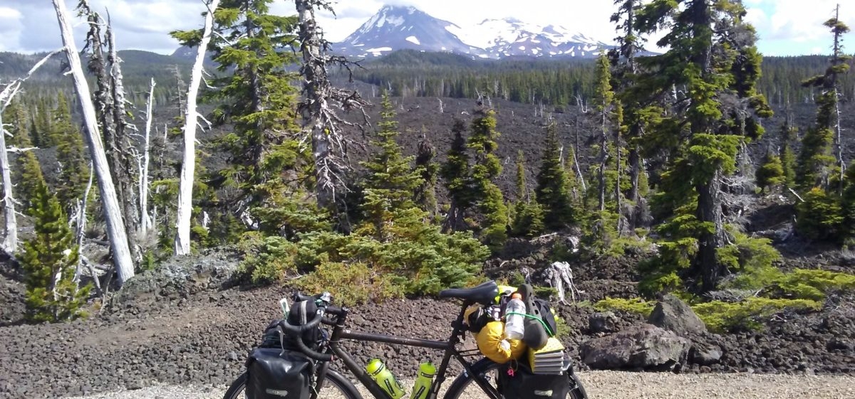
The store was exactly 4000 miles (6600 km) from where they started their bicycle ride, from New York to Virginia and on to the Pacific coast. They made me feel like such a wimp, I’m only up around 600 miles. I had stopped to talk to a friend of theirs earlier, he was a few miles ahead. He is limping along trying to make it to Baker City, OR with a broken spoke issue on his front wheel. That can be  a dangerous situation roaring down these mountain roads at fifty miles per hour. I hope he makes it okay.

I crossed into Idaho over the Snake River, which also meant a new time zone, one hour closer to home.

When I reached Woodhead Park I needed to stop. The temperature was 108 degrees F (41.222 C) and I was done in. I sat at the registration booth, which is also the restrooms and showers and tried to fill in the form for a tent site. I was so light-headed that I had to sit on the concrete walkway. I knew if I stayed standing I would go down. I’ve never passed out in my life, and this was as close as it gets.

As I sat there trying to sum up enough energy to fill in the form, a couple stopped to use the restrooms. They are regulars at the campground and were pulling their boat behind their green Chevy Tahoe. The woman passenger, Stephanie, hopped out and took one look at me and decided that maybe I could use a hand. I asked her how far it was to the restaurant since the campground doesn’t have any store. She said she thought it was five miles up the road further. She was incorrect, it is just over two miles, but that was the right answer for my situation.

I replied that I would just wait until breakfast time, I was too bushed to go that far in the heat. She informed me that she, and Jason, were on their way to the store for ice and would pick me up something. She asked what I would like and all I could muster was a sandwich and some Gatorade.

They left and I struggled to finish signing in and managed, somehow, to put up my tent. A while later Stephanie returned with the finest turkey sandwich I have ever eaten. She said she just threw it together at the cafe since they were in a hurry, but to me–it was a lifesaver. I was very depleted and didn’t even realize it. I’ve been taking in so much liquid that I have not had much of an appetite. I wasn’t so much dehydrated as just very low on energy from lack of food.

They drove off and I didn’t get  a chance to pay for anything. I asked where their site was and she pointed down the hill.

Later, after I had regained my strength, I walked down to where she pointed, but I didn’t see the green Tahoe.

Finally, an hour before sunset, although still very hot, I gathered the strength to ride the bike to the restaurant and gorged myself on a very good taco dinner, a ton of drinks, and followed it all with some ice cream.

I rode back to the camp, rode around and spotted their Tahoe and ran into Stephanie’s mom, Lisa. She found her daughter and I couldn’t thank her enough. She was astute enough to see someone needing help and took action. This is America at it’s best. Thank you, Stephanie and Jason.

I told her I would send her a signed copy of my book, Three Hundred Zeroes, since she wouldn’t take payment for my life-saving lunch.

Tomorrow morning I should be out bright and early, I have a 4000-foot climb to a pass, first thing.

© 2016 to 2021 All Rights Reserved