Day 19: Cambridge, Idaho to New Meadows, Idaho

Managed 48.42 miles (78 km) today.  This morning’s weather forecast stated: “Today will be MUCH COOLER than yesterday. Yesterday was 104.8 and today’s temperature will only be 92.0 degrees.” The bold text was in ice cold blue, with icicles. Break out the ear muffs and mukluks. I wondered if I’d need snow tires on the bike.

Seriously, I couldn’t believe the forecast. It must be automated and they didn’t consider what the temperatures really were. That said, it wasn’t a bad day, although I didn’t make it as far as I had wished. I was hoping for 72 miles (115 km), but I’m satisfied. Tomorrow I should be able to do nearly 80 miles to Riggins, ID, which is supposed to have a very nice park to camp in, in honor of veterans.

I say I should be able to make it because from all the information I can gather it will be practically all downhill to Riggins. Riggins will put me in a good strategic location to get to White Bird, ID, the next day. White Bird is at the foot of a, almost, 4000-foot (1219 m) climb. I suspect that I won’t go much beyond that climb on Wednesday. The profile of the climb looks like an upside-down icicle. That should be the last serious climb until Missoula, Montana. However, from Thursday on, it is one, long, gradual climb all the way to Missoula. Nowhere to go, but up.

20160731_103539~2
Pass, just east of Cambridge, ID

It may be hard to believe, but I started climbing shortly after sunrise from Cambridge, Idaho, only to get to the top of the 1400 foot (427 m) pass, then go down, and do it all over again.

One thing I enjoy here is lots of historical markers, here was one at this same pass:

20160731_103531~2

The crops here wouldn’t have been frozen this morning! When I took this photo it was already near ninety degrees F. (32.2 C).

The day ended in New Meadows, ID. Seeing a few Confederate flags around is a bit disconcerting, makes one wonder what is going through those heads?

Spending another night in a hotel, it is just too hot out there to get a good night’s sleep. When it is that hot it is too hot to go out and set up the ham radio and have some fun with that hobby. Maybe tomorrow night, we’ll see.

Day 18: Woodhead Park, Idaho, to Cambridge, Idaho

Only 26.39  miles (42.5 km) today, for a grand total of 639 miles (1028 km).

There was one serious climb over Brownlee Pass, 4131 feet (1259 m). Actual climbing from the campground was something like 2400 feet (732 m). The first 2/3 of the climb wasn’t too bad. I had stopped for breakfast at the cafe/general store two miles from the camp. I had pancakes that were way bigger than I could finish. Fueled with a big breakfast and extra Gatorade, I was off around 09:00 am.

As the altitude and temperatures started to climb, I started to look for shady places to take breaks and have a drink. The drill is pretty simple, look ahead for shade, pull over and rest the bike against something secure, take out the liquids, check the shady area for rattlesnakes and then sit and cool for a while.

I spotted a cattle loading dock right next to the road. They locate them there so the truck doesn’t have to get too far from the pavement. I decided to pull over and take a break and then changed my mind. It wasn’t rattlesnakes:

Dogs that beat me to the shady spot. One is under the ramp.

The dogs just gave me a sideways glance and I suspect I could have taken up space next to the brown one and he wouldn’t have cared, it was too hot. They didn’t even bark. I wasn’t about to tempt fate, I moved along.

Up the road, I eventually found a cement wall the Forest Service had built and took shelter there. You can see by my face that it is hot out.

20160730_092918

Eventually, I did summit and had a mostly downhill ride to Cambridge, ID, and air conditioning.

20160730_121414~2

It always feels so good to see that elevation sign, this means it is time for some well deserved downhill.

Day 17: Halfway, Oregon to Woodhead Park, Idaho

38 Miles, (61 km). I had planned to bike twice that distance, but the sun and heat had other plans for me.

On the way, I stopped at a general store by Hell’s Canyon Inn, about 15 miles into the day. The ride was unusually easy and I was making good time, although it was warming up. At the store, I ran into Alexis and Brian (sorry if that isn’t correct, my memory gets foggy with heat!)

20160729_103513The store was exactly 4000 miles (6600 km) from where they started their bicycle ride, from New York to Virginia and on to the Pacific coast. They made me feel like such a wimp, I’m only up around 600 miles. I had stopped to talk to a friend of theirs earlier, he was a few miles ahead. He is limping along trying to make it to Baker City, OR with a broken spoke issue on his front wheel. That can be  a dangerous situation roaring down these mountain roads at fifty miles per hour. I hope he makes it okay.

I crossed into Idaho over the Snake River, which also meant a new time zone, one hour closer to home.

When I reached Woodhead Park I needed to stop. The temperature was 108 degrees F (41.222 C) and I was done in. I sat at the registration booth, which is also the restrooms and showers and tried to fill in the form for a tent site. I was so light-headed that I had to sit on the concrete walkway. I knew if I stayed standing I would go down. I’ve never passed out in my life, and this was as close as it gets.

As I sat there trying to sum up enough energy to fill in the form, a couple stopped to use the restrooms. They are regulars at the campground and were pulling their boat behind their green Chevy Tahoe. The woman passenger, Stephanie, hopped out and took one look at me and decided that maybe I could use a hand. I asked her how far it was to the restaurant since the campground doesn’t have any store. She said she thought it was five miles up the road further. She was incorrect, it is just over two miles, but that was the right answer for my situation.

I replied that I would just wait until breakfast time, I was too bushed to go that far in the heat. She informed me that she, and Jason, were on their way to the store for ice and would pick me up something. She asked what I would like and all I could muster was a sandwich and some Gatorade.

They left and I struggled to finish signing in and managed, somehow, to put up my tent. A while later Stephanie returned with the finest turkey sandwich I have ever eaten. She said she just threw it together at the cafe since they were in a hurry, but to me–it was a lifesaver. I was very depleted and didn’t even realize it. I’ve been taking in so much liquid that I have not had much of an appetite. I wasn’t so much dehydrated as just very low on energy from lack of food.

They drove off and I didn’t get  a chance to pay for anything. I asked where their site was and she pointed down the hill.

Later, after I had regained my strength, I walked down to where she pointed, but I didn’t see the green Tahoe.

Finally, an hour before sunset, although still very hot, I gathered the strength to ride the bike to the restaurant and gorged myself on a very good taco dinner, a ton of drinks, and followed it all with some ice cream.

I rode back to the camp, rode around and spotted their Tahoe and ran into Stephanie’s mom, Lisa. She found her daughter and I couldn’t thank her enough. She was astute enough to see someone needing help and took action. This is America at it’s best. Thank you, Stephanie and Jason.

I told her I would send her a signed copy of my book, Three Hundred Zeroes, since she wouldn’t take payment for my life-saving lunch.

Tomorrow morning I should be out bright and early, I have a 4000-foot climb to a pass, first thing.

Day 16: Baker City, Oregon to Halfway, Oregon

56.62 more hot miles today, for 571.52 miles total. There was a very optimistic bicycle store sign leaving Baker City, for a store in Kansas. Only 1510 miles (2430 km) ahead.

20160728_081236

It was super hot out there. It was so hot that I stopped at Richland, 13 miles from my destination and slept in the shade for a few hours.

The Grange organization in Richland has a really nice park with a pavilion, so I went in and napped on the stage.

20160728_170407

There was nobody around. The woman at the cafe in town suggested I go there, she said nobody would bother me and she was correct. I didn’t check the thermometer, but I suspect 100+ F. I can’t imagine what it was like for those settlers coming across on the Oregon Trail. I’ve made several attempts to put a photo of an Oregon Trail memorial in here, but WordPress keeps insisting on putting it in upside-down. Why? I have no idea.

The cafe was interesting. It was all old cowboy types and tall tales. Off in the corner was a big screen TV playing some hunting channel. What caught my eye was that the whole time I was there they were doing a show on the AR-15 and then went to a show about some machine gun. Hunting? I couldn’t make the connection.

I stopped at Richland because the profile map showed a huge climb going to Halfway. It was just too hot for a climb where there is no shade. I wisely waited and made it to Halfway just as it was getting dark. Tired, I opted for the first place I found to stay—a motel.

Of course, the town restaurant and convenience store closed at 8 pm, and I was about five minutes late. With all the heat I wasn’t hungry anyway, so I grabbed a few cans of soft drink, a bunch of water and some trail mix I was carrying on the bike, and nibbled before going to sleep.

Timing is everything.

Days 12, 13, 14, and 15: Baker City, Oregon

20160727_112404
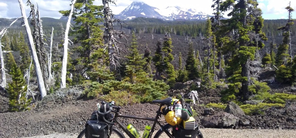
515 Miles ridden from Lincoln City, Oregon to Baker City, Oregon. I’m almost into Idaho and should be there by tomorrow.

As mentioned previously, I had to spend several days in Baker City to repair my Chromebook computer screen. Most of the days were spent eating, sleeping, swimming in the motel pool, and going to the park. They have some very nice parks here and the citizens use them.

Most of the time I would go to the park and throw a wire into a tree and get on my ham radio. Since I didn’t have the Chromebook, I would mostly talk to people on Morse code, or what we hams call, “CW,” it has to do with how the signal is formed and means, “Continuous Wave.” Actually, it isn’t continuous, the code key turns the signal on-and-off to form the characters, but such is how things get named.

On my last night in Baker City, I was in the park after dark. Some local group sponsored a movie night in the park pavilion and there was a great turnout of young kids to watch it. Everything ended about 10:00 pm. I had just finished talking with a fellow in Santa Clara, California, KK6ZHK, Ken, when a police officer walked over and asked me what I was doing.

I had the computer, antenna, radio, batteries, wires everywhere and I’m thinking he must see me as an Al Qaeda operative. At first, he looked a little nervous. I explained what I was doing and I saw a light go on in his head, he had heard of ham radio. Whew.

He told me the park was closed and I’d have to tear down. He explained that they had had “youth” problems lately after dark. I explained that I wasn’t a youth, but he didn’t have much of a sense of humor, so I went back to the motel.

Water source about 15 miles up SR-7 and 31.5 from the center of Prairie City, going east.

Going back to the ride from Prairie City to Baker City: The difficult part of the day’s ride to Baker City was not only the 68 miles but riding over three passes that were all over 5000 feet (1524 m). After that, there was another section that had various ups and downs before truly descending along the Powder River into Baker City. I left Prairie City shortly after sunrise and arrived late in the day in Baker (the locals just refer to it as “Baker.”)

The other big question riding from Prairie City to Baker city is water. The map showed nothing between their home and Baker City, but Jimi and his son, Daniel, filled me in on some sources that were not on the map. Just about a mile after the restaurant at Austin junction with SR-7, there is a water pipe coming from a spring and it had plentiful water. It is directly across from the entrance to the Bates State Park

At 31.5 miles from their place, mile marker 15 on SR-7, at a highway maintenance building someone leaves water out for bikers. True to their word, both places offered plentiful water. Thank you, citizens of Oregon.

When I finally pulled into town, I wasn’t certain about where to stay. I called Jimi and asked him because he had mentioned a few places and I made the mistake of not paying attention. He suggested that he call a friend that was sometimes on WarmShowers and even though I considered it very late in the day, he gave the friend a call and then called me back.

His friend, Gayle, said yes, come over. I arrived, almost delirious from the heat and exertion. I felt that I was just babbling, but she took it in stride, showed me some of the nicest soft grass to put my tent on and, like everyone else, set me up with a shower and towels. I washed and crashed into my bedroll, oblivious to the world.

I slept like a dead man.

The next morning I told Gayle I was interested in taking a “zero day,” a day with no miles, to rest up and she suggested several places that were reasonably priced and had WiFi. I opted for the Oregon Trail Motel, on the other side of town.

Thanks for following along and please do leave comments.


Day 11: Prairie City, Oregon

Today’s ride from Dayville to Prairie City was almost 47 miles. Once again, relentless heat and blue skies. I can take the skies, and I haven’t had rain since beginning this journey, but cool air would be refreshing.

The ride wasn’t too bad. I managed to do it in about five hours and saw some really spectacular country. Mountains in every direction and a few even have traces of snow on them.

I’m seeing midsummer plant life now. Most of the fruit on the trees, such as apricots and juniper are ripe. They use the juniper berries to make gin.

20160723_153257

I arrived in Prairie City in the late afternoon. I once again had arranged to stay with a WarmShowers.org family. Nobody was home when I arrived, so I collapsed on a bench in their garden and fell fast asleep. About an hour later, I heard a car stop on the road below and Jimi hopped out and ran up the bank to the garden where I was. He didn’t seem surprised in the least and invited me in. He showed me around, gave me a place to put my sleeping gear, pointed out the all-important shower, and then left me alone.

20160723_165944
View of Strawberry Mountain from my sleeping position. 9042 feet (2756 m)

The view from the room was breathtaking, looking out towards Strawberry Mountain. He had offered for me to join him and Karen for dinner, but I opted to walk down to town and get a few things. The next day’s ride was about 68 miles (109 km) and I wanted to have something to eat. Food wasn’t certain until Baker City. I learned later that there was a restaurant/convenience store about 20 miles (32 km), but there was some question as to whether it would be open on Sunday…it was.

20160723_161152
You know there are rednecks around when you see a sign like this.

I slept a deep sleep in Prairie City after going out and looking at the star-filled sky. The stars are brilliant here, something one rarely sees in Florida.

Thanks for following along and please do leave comments.


Day 10: Dayville, Oregon

I’m writing this entry on Day 15, in Baker City, Oregon, but didn’t want to jump ahead, I might fail to come back and fill in the story. Yes, for those of you that read my last posting, Day 9, I do now have my Chromebook computer back.

The ride out from Mitchell, OR, faces another steep climb to the top of Keyes Pass. At 4369 feet (1332 m) it isn’t highest climb thus far, but it averages about a 7% grade.

20160722_111013The good news is, the downhill to Dayville is about 33 miles (53 km). It was gradual, I don’t think I broke any speed limits, but it was a relief to not pedal too hard in the desert heat.

About halfway down, I was approaching a ranch entrance off to the right. I think the ranch was named, Great Creek Ranch. In any case, just as I neared an entrance gate to a field an animal jumped out in the road in front of me about 50 feet (15 m) ahead. At first, my foggy, heated, brain didn’t register what it was.  Dog? Pig? Antelope? Gradually my brain started to assemble the pixels and it registered that it was a cat. It was then that I realized that the cat was large, very large. In fact, this was the largest cat I had ever seen in the wild. It was a cougar, also known as a mountain lion or puma.

It all happened so suddenly that I think we were both surprised. The bicycle is silent and the animal was used to hearing traffic on the road and chose the silence to cross. It stopped right in the middle of my lane and looked right at me. Instinctively, I rode directly towards her (it did look like a female cat, I could be wrong). After what seemed an eternity but was probably a few milliseconds, she turned, darted and ran off into the bushes on the side of the road.

I didn’t even have time to be scared. I was rolling along about 10-15 miles per hour. I think they can run about 40 or 50 mph. What if she took me for game? Whew. Nonetheless, that cat was a breathtaking sight. The locals here tell me I was lucky, not many actually get to see them, sightings are rare even though the cats are not.

In midafternoon, I arrived in Dayville. It is just a few buildings and has a population of 148. A quick stop at the cafe for some cold drinks was in order. I’m certain I was a sight, all sweaty, dusty, and sun burnt. After cooling down I went down to the church, which was reputed to be a biker hostel. I didn’t find anyone there, so I just parked on the lawn in the shade and laid on the grass and promptly fell asleep. After an hour or so a neighbor, Cindy, came along to mow the grass and water it and told me where I could find Rose, the hostel proprietor.

She lives just behind the church and immediately made me feel at home. She opened up the church and attached meeting room/kitchen and invited me to use the place. Nobody else was there, although she thought there were two others that would show.

I unpacked, put down my mat and sleeping bag on the floor and connected the electronics to the WiFi. I also put up an antenna on a nearby tree for my ham radio later that evening. Following a refreshing shower and cleaning up, I put on some regular clothes, as opposed to bicycle riding clothes, and headed back to the cafe for dinner. When one of the waitresses they spied me she commented: “Hey, you’re not half bad, once cleaned up.” I wasn’t quite certain how to take that, was I that bad before?

Back at the church, the other two did show up, Issac and Kevin, both young fellows doing an east coast to west coast ride. They’re doing it on a budget and have about a week left. Issac had an interesting arrangement for his gear. He was pulling a trailer and the hitch had broken quite some time ago. It was rigged up with bolts, tie-wraps, and bailing wire and seemed to be working. I couldn’t have imagined how one would replace the rear tire, should that be necessary. Sadly, I didn’t think to take a picture. Maybe if he sees this, he will send one along.

The rest of the evening was uneventful and I did mess around with the radio for a while before turning in for a very good night’s rest.

I may come back and add more photos to this later, the Internet connection is so slow here that it is impossible to do at this time.

Day 9: Mitchell, Oregon

First of all, I am posting this from the library at Baker City, which is day 12-14 of the journey. I have gotten behind for various reasons, mostly just due to being old, hot and tired.

More importantly, my bicycle managed to fall over a few days ago onto a strategically placed rock. The impact to my imperfectly packed Chromebook laptop destroyed the screen:

20160725_095434

That pretty “flower” pattern is the result and, of course, there is no data display. I was lucky to find someone to repair it. Thankfully, the inexpensive, new screen will be delivered tomorrow (27 July), I’ll soon be on my way on Thursday morning, and into a new state (Idaho), a new timezone, and new mountains to climb.

Anyway, I’ll save all that for the future postings, once I catch up. Now, about Mitchell, OR.

I left Prineville (rhymes with “wineville”) early in the morning, just after sunrise. The climb out of town was the usual ascent into the sky. By midday, I was feeling quite tuckered. Fortunately, I did carry a good stock of Gatorade and water and, in spite of the heat, was doing a bit better than previous climbs. I reached Ochoco Pass (4720 feet, 1438 m) and took a good rest period; I think I even fell asleep for a bit in the shade of a tree.

The one saving grace of these big climbs is the following descent, and this one was no exception. Even in the hot desert air, it felt somewhat refreshing, although it was still a refreshing blast furnace of heat.

Coming into Mitchell, I observed a tire shop and espresso shop, all in the same building. I just couldn’t bring myself to stop. I had this vision of a fellow in greasy work coveralls, running an espresso machine and passed it up. Later on, just down the road, I took the main street into town and hit the first cafe on the right.

The young lady (they all seem younger than I am now) working the counter offered me several drinks, Pepsi, lemonade and water and I had several of each. Even though I wasn’t that hungry, I ordered a BLT. She cooked up some fresh bacon and as she made the sandwich, we chatted. She was pleasant and has a college degree, I think in one of the sciences, but there isn’t much call for that around there, so she is making do. She was originally from Tennessee, as I gathered from her accent. Funny how some things we just never shake.

While chatting, another woman, Jalet, came in and realizing immediately that I was a bicyclist, filled me in on her biker hostel, the Spoke’n Hostel, just down the road. I must have been tired and hot, I completely missed it on the way to food and drink. It is a converted church and a super place to spend an evening.

More to come later, I just had a notice on the screen the library is timing me out for today. I’ll be so glad to get my Chromebook back!

Day 8: Prineville, Oregon

After leaving Bend, I rode to Prineville, OR, some 43.8 miles (70 km). Even though it wasn’t a particularly challenging route, the heat was oppressive and the terrain is becoming much more desert-like. I was glad to see the day end.

I stayed with another WarmShowers.org host, Kim and Dennis. I didn’t meet Dennis, he came in later, but Kim set me up with a place to sleep in their yoga studio. They teach yoga and the large room is a biker hotel at night.

After a hot shower, I roamed into town, had some chow and lots of liquids and then returned. In my absence, a few other riders had arrived. One was a fellow doing a coast-to-coast ride from Virginia to Astoria, OR, and the other, a French-Canadian woman doing a six-month journey around the country. What made her interesting was that she was pulling a trailer with a dog, a black lab, in the trailer.

I didn’t actually meet her, but could see her down in the courtyard with her dog and bike. I understand that her longest day so far was 18 miles (30 km). Amazing.

The coast-to-coast rider wasn’t terribly sociable so we didn’t talk much. It is a shame, I had some questions about the road east, but I guess I’ll just have to find out for myself.

In the morning, Mr. Unsociable had his alarm set for about 05:15, headed out about 05:30 into the darkness with no lights on his bike and left the garage door open. As I watched him leave from the second story window I wondered how he doesn’t get killed riding on those roads in the dark.

I got dressed, brought my gear down and loaded the bike. When Mr. Unsociable left, he didn’t turn off the garage lights or close the door. My bike, as well as all the other bikes in the garage, were totally unsecured. It was an open invitation for someone to roll away with a new bike. Lesson learned, lock up my bike, even indoors.

As dawn broke, I rode back into Prineville village to dig up breakfast. Not much was open, not even McDonalds, but I did manage to find a Tastee-Freeze that served breakfast and it was actually very good.

Summits to climb today, Ochoco Pass, at 4720 feet (1439 m), I’m starting to feel my age, especially with this heat.

20160721_154514
Operating ham radio from Ochoco Pass, Oregon

Days 6/7: Bend, Oregon

20160718_151412 (1)
Phil, outside a “ghost town” general store

This is just a quick note. I have to hit the road soon. I just wanted to thank my friend Phil in Bend, Oregon. Jane and I met Phil on the Camino de Santiago in 2011 and he insisted that I stop to see him as I crossed Oregon.

He and his family were exceptional hosts and made me feel like a king. He took time from his busy schedule to give me a tour of the immediate area.

20160718_171338 (2)He showed me his “secret” gulch where we explored various flora and fauna of the area, this was my first exposure to the desert regions of Oregon, and I found it fascinating.

Thanks so much for having me in Phil and I hope I can reciprocate one day.


© 2016 to 2021 All Rights Reserved