Tired, wet, cold, exhausted, yet satisfied it is almost over. I still have to go dip a wheel in the Atlantic.
Arrived at my daughter, Áine and son-in-law’s home at 17:05 after 39.54 miles (64 km). The trip total is 4091.62 miles, or 6585 km.
I set out from Nashua, NH late in the morning, figuring there was no rush. I forgot to check the weather forecast. Around Salem, NH it started to get colder and started raining. Even though I am familiar with the area, I decided to use the GPS to find the shortest route.
I haven’t lived here in many years and there are all sorts of new residential areas. Using the GPS bicycle navigation it took me through many areas I wasn’t familiar with. As the rain intensified, the raindrops started hitting the phone/GPS screen and acted as finger taps. I would look down and see a map of the world with a little red spot showing I was in the United States, or it would have opened some other app, such as Solitaire. It was getting useless, so I carried the phone in my rain coat pocket.
It would mumble something about “GPS signal lost.” I took to taking the phone out, restarting GPS, memorizing the next few miles and then putting it away. This really slowed progress.
When I arrived in Haverhill, MA, it was a downpour. Suddenly, something splashed into my right eye and I couldn’t see a thing. I’m figuring some toxic waste from the road had blinded me. It was burning like hell. Then I realized that I had not ridden in the rain for some weeks. All my dried sweat had accumulated in my helmet and the water was now releasing it, it would then drip down into my face and eyes. I cannot describe how painful it was, totally blinding me. I pulled over and wiped out what I could. With all the potholes and puddles, I needed keen eyesight, it could have proved dangerous.
Even though I had a good breakfast at a Paneras and stopped for a BLT at an IHOP, I was running low on energy. My body, for the last few days, was begging me to stop. I kept going but found that I was getting off the bike and pushing it up the smallest hills, I just had nothing left. It is fortunate that this trip is coming to a close, if not, I could see having to take a week off to build up my strength again. This wasn’t such a problem when I was younger, am I getting old? Perhaps? Naw, couldn’t be. Maybe I’m just getting over that cold I had.
When I was about a mile from Áine’s home a road crossing had a sign that said the road was closed, the bridge was out. I was tempted to ride down and see if I could get across with a bicycle (I know the bridge) but decided to ride around the lake. I just couldn’t fathom having to come back up from the bridge, so added another three miles (5 km) to the ride. So be it, I was too tired to argue with myself.
Me, consulting with rest and sleep master, “Midnight.” When it comes to sleep, he is an expert.
I let myself into the house. The dog was glad to see me, but the cat (Midnight) was absolutely thrilled. What a strange twist, it is usually the other way around. In any case, following some rest, I will continue with this story in another post. I’m too tired to continue.
The day started out cool and sunny in Brattleboro, VT. It was a quick ride down a very steep hill to the bridge crossing the Connecticut River into New Hampshire. I decided that, for the most part, I would just follow NH119 east. It was a good choice, the road surface was excellent, with plenty of shoulder room. Unfortunately, until I reached Fitzwilliam, NH it was very much like the road out of Bennington, VT, lots of climbing and running out of breath.
Jack, W1PFZ, welcoming me to the east coast. We had never met in person, only via ham radio.
About 13 miles along, I spotted a fellow on the other side of the road standing next to his vehicle and waving his arms at me. For whatever reason, I somehow suspected it was a ham radio friend that I had never met in person, Jack, W1PFZ. Sure enough, he had been following my postings here and calculated where he thought I might be. He drove up with Ann (sp?) from Ashburnham, MA just to be my personal welcoming party to the east coast. How cool is that? Hams are like that, I wonder if there is a medication for it?
After Fitzwilliam, I continued east on NH119 and the road became more level. Of course, by then, my energy was sapped. A typical ride on level ground with just the weight of the bike is around 3400 calories for a 70-mile ride. I would venture that the first twenty miles of today’s ride burned that much. Judging by my serious weight loss, I suspect I’m not too far off the mark. By the end of the day, my legs are rubber. These New England hills are the toughest part of the coast-to-coast ride. My daughter, Aine, said the same thing when she did this ride.
I’ve been seeing groups of 10-20 turkeys everywhere I go. They usually scatter before I can get a good photo. I hope they get the memo about Thanksgiving.
When I was a kid in Connecticut, I rarely saw any wild turkeys. They were practically extinct in the region. Through care and concern, they have been brought back, and they have certainly recovered. In NY and New England, I am seeing them everywhere, in huge numbers. I would venture that on today’s ride I’ve seen at least 2000 birds. I laughed when, a few weeks back, I saw a bear chasing a turkey, to no avail. The wild turkey, unlike its domestic relative, is very cagey and smart, the bear never had a chance.
NH119 turned into MA119 in Massachusetts. It became a pothole hell. It was actually dangerous on a bicycle, motorcycle, or in a small car with narrow tires. Some of the holes were a foot deep and I really had to watch for them. Going 40 MPH (65 km/h) downhill, with tearing eyes, it became a dangerous game. At one point, as a car was passing, I had to revert to my old mountain bike talents and force the bicycle to “jump” over a very deep hole at top speed. I just cleared the pothole. Had I gone into it there would have been serious rim damage, or worse. I should have taken a photo. The pothole, one of the thousands, was at least a 3-4 feet (1 m) across and a foot (.33 m) deep.
Later, in a restaurant, I saw a politician in a campaign ad claiming to have cut taxes in Massachusetts (I think it was the current governor, Charlie Baker). I’d love to invite him to ride MA119 with me across the state. If he survived it, he’d be less inclined to brag about cutting taxes and subsequently, cutting road maintenance. Sorry if I vent on this, but this is outright dangerous and when they cut taxes, they should explain what else gets cut…there is no free lunch. I’ll bet automobile front-end business is thriving.
I really wanted to make it to the Nashua, NH area for the evening. This would put me in a good spot to finish the next day in Newburyport, MA. I pushed on as the sun got lower and lower. It finally started getting dark enough that I had to turn on my headlamp and three rear lights. At around 19:15 I rolled into a Motel 6 on Spit Brook Rd, Nashua, NH and found that they did in fact, “Leave the light on,” for me. I don’t know what the temperature was, but several folks asked me if I was cold, the locals thought it was cold. When working that hard, I must admit, I didn’t even notice.
It was a 72 mile (120 km) day. I was spent, but happy. I put the bike in the room, walked out for an evening meal and was asleep by 22:00. In all, it was a good day. Tomorrow, it is on to Newburyport.
Appalachian Trail and Vermont Long Trail crossing on VT9.
42.09 Miles (70 km) for the day. I hit a maximum speed of 41.14 going down one of the many Vermont hills. Vermont is one tough state to traverse, either on foot or by bicycle. If you’re not going up, you’re going down.
The first ten miles (16 km) out of Bennington, VT were uphill. A little over two hours after starting I was ready to call it a day! I was exhausted and it wasn’t even lunchtime. My legs were turning into rubber, I felt like I was a human Gummy Bear.
At one point I passed the road crossing for the Appalachian Trail (AT) and Vermont Long Trail (VLT). The trails come down a steep mountain slope on one side and go right back up another steep slope on the other side. I recall how relieved Jane and I were to arrive there when we hiked the VLT. We hitched a ride into town and spent our first night off of the trail and out of the constant rain we experienced on that hike. It was nirvana.
Just up from the trail crossing, I ran into two hikers that were looking for the crossing, Brendan and Alyssa (?), with their dog. We talked about hiking the AT and I mentioned the book, Three Hundred Zeroes. It will either convince them that they want to hike it or convince them that they absolutely don’t want to.
I rolled into Wilmington, VT around 13:30. A friend, George (see comments) asked me to stop at Dot’s Diner there. I did, but the place was so mobbed that I really couldn’t schmooze with the staff, they were flat out busy. Maybe next time.
Leaving Wilmington, going east, it was more climbing, up to the Hogback Mountain pass. The mountain holds fond memories for me. The Labor Day before I left for military duty in 1965, I took my two brothers on a road trip. We went from Connecticut to VT9 in Vermont, at Brattleboro, then went up to Hogback Mtn. This trip was in a 1954 Chevy that I had rebuilt from the ground up with my own two hands. It was a six-cylinder of questionable performance, but I built it. It was all back roads from CT and late in the day when we arrived there.
Where we camped in 1965, it is now a trailhead.
We “cowboy camped,” across the road from the mountain lookout point. There was an empty, overgrown, field there. It was a starry, cool night and we just slept on the ground without a tent. If it rained, we could just pile into the car. The stars were just exploding over our heads, it was so clear and crisp. We dozed off.
At about three AM I heard a noise and looked over at my brother, Tom. There were two deer standing over him, sniffing him and one over at my brother Ernie. I didn’t dare move and spook them. They then wandered around munching leaves and enjoying themselves. What a sight in the moonlight, it is still so vivid in my mind.
The top of Hogback Mountain, where the fire tower was at one time.
The next morning we wandered across the road and climbed to the mountaintop to a fire tower that was there (it is now gone). There was a fire warden up in the tower and he called down to us to come on up. Ernie was skeptical (he never did like heights) but Tom and I climbed up. The fellow in the tower was glad to have somebody to talk to and handed us binoculars and gave us a visual tour of the region. From there I think we were able to see seven states and Canada. What a thrill!
We climbed down and then drove over to Bennington, VT and went up the 306 foot (92.3 m) Revolutionary War Memorial Tower there. We then headed home. It was the only road adventure we ever did together. I went off to military duty and two and a half years later, lost my brother Tom in Vietnam. I’ll always treasure that trip and those moments.
Mt Monadnock, in New Hampshire, from Hogback Mountain in Vermont.
Today I was able to see Mt. Monadnock, in New Hampshire. It looked to be about forty miles away. Tomorrow I will be riding across NH and in, perhaps, two days my ride may be coming to an end. The ride down the east side of the mountain is very rapid. I hit speeds of around 40 MPH (65 km/h) consistently and peaked at 41.14 MPH. Unlike the west side of VT9, the east side is not in very good shape, especially the shoulder. The GPS kept insisting that I take alternate routes ( I had it set for bicycle) and now I understand why. I ended up walking for a few miles and pushing the bike because the shoulder was a crumbled mess and impossible to ride on, and the road wasn’t much better. It is a shame, it is a beautiful ride.
For just over forty miles, I was totally spent when I reached Brattleboro. I looked on my GPS and it showed an Econolodge Motel nearby. I called ahead and booked a room. The GPS took me through some back streets. One is Union St. Holy Mackerel!!! It was so steep it was like driving off a cliff. I cannot imagine driving that street with ice. Of course, going down meant, going up. It was so steep, I finally gave in and pushed the bike, I couldn’t pedal up the “wall.”
I’m actually writing this the next morning. It is 42 degrees F out there (5.5 C). At least the sun is shining.
My first sighting of the Bennington Revolutionary War Monument, Bennington, VT (between the trees)
Bennington holds a special place in my heart. It is one of my earliest memories of a road trip. My Mom, Dad, brother Tom (not yet a year old) and I went there from Bristol, CT on a day trip. We rode with my brother’s god father, my dad never had a car that would make it that far. I recall standing at the base of the Bennington Revolutionary War Monument and seeing my dad wave his blue hankie from the top of the monument.
Today’s ride from Schenectady started out in the rain. It was cold and slow going for a while, but after about an hour the cold rain ceased and the riding improved. I followed the last of the Eire Canal that I would ride, then turned northeast, towards VT. There is an old saying that “What goes up, must come down.” The opposite is also true, at least in hiking and biking. Going into Troy, NY was a downhill section. I could see, across the valley, that I would start climbing, and I certainly did. It was extremely hilly, I was down into my lowest gear, going along at 3 MPH (5 km/h) at times…for long stretches. I had to climb about 2000 (700 m) feet for the day. At least the weather cooperated, no wind and some sun. My 55.01 miles (85 km) was hard-earned.
I went for an evening meal at the Madison Brewery and Restaurant in Bennington. The food and brew were outstanding. I had clam chowder and chicken and biscuits and it was one of the best meals of the entire ride. Jane and I stopped there when we hiked the Vermont Long Trail.
It felt great to be crossing into another state, only two more to go. The cold still lingers, but isn’t too bad and not hindering me much. Onward!
One of the more modern locks on the Eire Canal. Sometimes the ride goes past the older canal system that was bypassed, they have nothing like this.
The morning broke in Little Falls, NY in much better shape than the previous days. The sun was peeking through an early morning haze that promised to evaporate, and did. After a NyQuil induced sleep I had trouble actually waking up. I had awakened around 02:30 and the prescription suggests taking NyQuil every six hours, so I took the second dose.
After groggily drifting through a light breakfast of Frosted Flakes and toast, I went out to meet the day. I prefer Cheerios, but one takes what one can find. They had a full compliment of waffles, eggs, etc., but all that stuff is just too heavy for first thing in the morning.
I set off down NY 5, rather than the Eire Canal Towpath. With all the rain over the last two days I didn’t relish riding through mud and puddles. The path is pretty well maintained, but I didn’t want to invite any problems. NY 5 has a reasonable shoulder and, believe it or not, the NY drivers have been really decent. They should drive as well when they get to Florida.
My cold was nowhere near over yet, but I hoped to get to at least the 60 mile mark (98 km). I’ve been losing too much time laying around and I want to get back to help Jane out with things. Today’s route had some notable hills, but at least they pay back the energy. The good news: there was absolutely no wind at all.
When Jane and I built our log cabin, we ended up removing hundreds of stumps. It was dangerous and hard work. Here is what the workers on the canal did, those wheels were massive and multiplied the energy from the oxen significantly.
Feeling dehydrated (NyQuil?) I stopped at 10 miles (16 km) for a hot tea. Did I mention the day was much cooler? I was wearing long sleeve layers and my leather motorcycle gloves. At 22 miles (33 km) I decided on an early lunch, it was only 11:30. I pulled into the Hungry Bear Cafe. I locked up the bike and walked into the entrance. When I walked through the door I heard a muffled gasp and out of the corner of my eye I spied two women, poking their friends and nodding in my direction. Keep in mind, these women could have been from the Golden Girls TV series. I could have called them “Mom.”
There were no other men in the room. It seems there must be a male shortage around there, I could feel my every move being watched. I was tempted to give them a big grin with my missing tooth, but I suspect that would have spoiled the fun. They probably don’t see too many tall men in tight fitting bicycle clothing, it may have made their day…who knows?
I had a good chuckle with that experience and then headed out once again. I wasn’t 100%, but was making decent progress because the weather was so agreeable. I made several more stops to hydrate and rest. When I arrived at Schenectady, my GPS was all confused. It took me to NY University and had me riding around in a circle in the parking lot. Go figure.
Finally, I spotted a VERY expensive Hampton Inn, located in downtown Schenectady. It was getting late, I was bushed and I got a room for what some people would pay for a home in the third world.
Time for more NyQuil and rest. Tomorrow, I should be entering Vermont, around Bennington. Thanks for riding along. Oh, I was delinquent today, I didn’t even take any photos; I just wasn’t myself. I’ve included a few from elsewhere.
Sometimes the canal towpath is well marked, such as with this sign. Other times there is no sign at all, or it is so faded as to be unreadable.
An easy 23 mile (39 km) day. I rode from Weedsport to Syracuse in good weather. My GPS was actually working and allowed me to find the car rental place without difficulty. The original rental (on line) showed some sort of small SUV, I ended up with an Altima sedan, it was supposedly an upgrade, but putting a bicycle in it looked daunting.
Fortunately, the rear seats folded down. We couldn’t figure out how to bring down the driver’s side rear-seat and the rep had to run off. I finally looked in the manual and found there is a strap hanging down when one opens the trunk, pulling on it released the seat.
The opening wasn’t quite wide enough to load the bike into the car. Once I removed the bicycle’s seat, I was able to get it in…barely. After about an hour, I was good to go.
I’ll skip the next few days, except for a few important things. I went to my daughter’s in Newburyport, MA. As planned, Jane (my spouse) was to arrive there and I did meet her as planned. On Saturday night, we attended a friend’s wedding. While dancing, Jane managed to injure her knee with a meniscus tear. While dancing she claimed she heard something “pop.” Additionally, she was wearing awful shoes for walking and dancing. All the stressed added up.
Lessons on how to destroy a left knee.
She walked out to the car without much pain, but by the time we returned to our daughter’s place, she had difficulty getting out of the car and winced at every little move. I felt she should get it looked at, but she was concerned about catching her plane back to Florida the next morning. We went to bed and at around 1 am, we got up and headed to the Anna Jaques hospital emergency room. As luck would have it, our son-in-law had a walker and it allowed Jane to make it to the car. Without it, I think it would have been an ambulance ride, what with stairways and all. At this point she was in extreme pain.
The staff at the hospital were excellent and, following an X-ray, determined it was the meniscus tear. They gave her crutches and lessons and a leg support and sent us home. She did manage to make her flight to Florida, although Homeland gave her the going over because she had to be a terrorist wearing a leg brace. Go figure. She brought along the hospital paperwork, just in case, but I guess that wasn’t good enough.
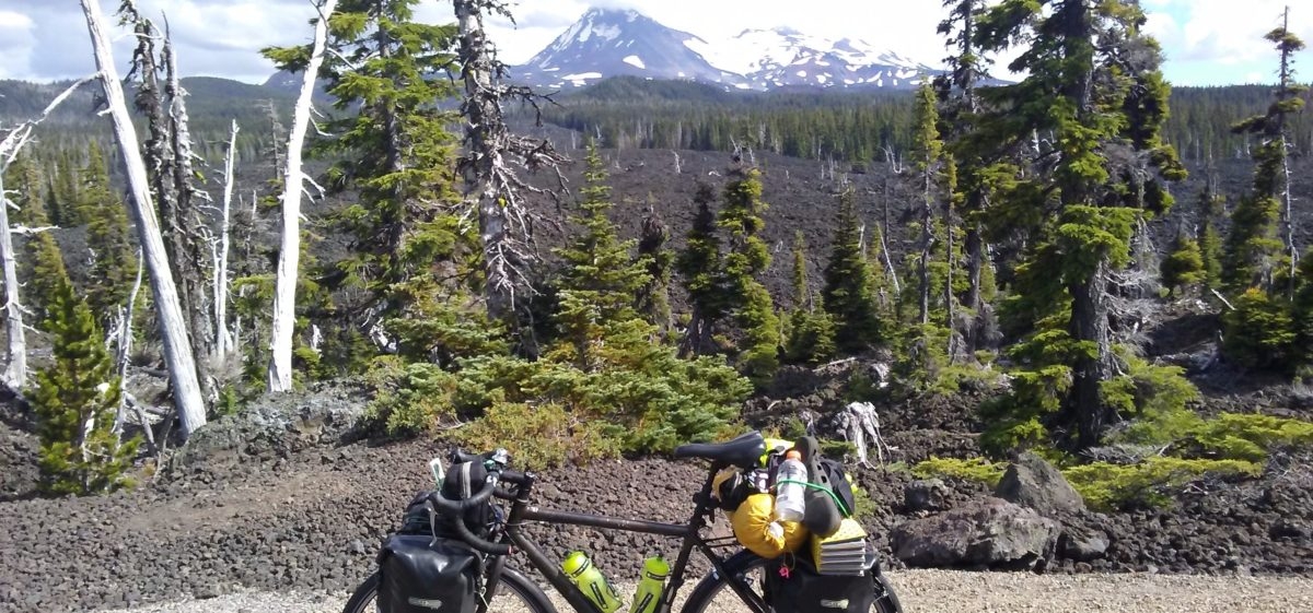
The bike fully loaded. I’ve abandoned the yellow tent on the back, and the sleeping pad under it and the contents of the left pannier (the radio gear). The bag on the front is now in the left pannier.
After sending Jane off I faced a decision. I had tried to convince her that I should postpone the ride again and go back to Florida to help her. She INSISTED that I continue. I agreed but felt that I should make haste to finish. With that in mind, I have jettisoned my tent, sleeping mat and, this is painful: my ham radio station. This lightened the load by twenty-two pounds (10 kg). My thinking is I will be able to travel quicker in the mountains ahead and I won’t really have time to stop for leisurely radio operation. I know this will be disappointing for my ham radio friends, but such is life. I will promise, when I get to Newburyport, MA to fire up the radio (letting everyone know in advance) and contact those of you that have missed me thus-far. After that I will ride the bike down to the Atlantic Ocean and do the traditional “wheel dip.” Oddly, it won’t be with the same bike I started with, I totaled it in Minnesota.
I returned to Syracuse, NY on Monday. After dropping of the rental car, I again headed east. The GPS guided me through all the Syracuse back streets and in no time, I was back on the Eire Canal towpath. The day was sunny and very windy, but the towpath has so many trees around it that the first forty miles (65 km) were relatively easy. I decided I would go to a Best Western motel that I had stayed in the night before, in Utica, NY. It was 65 miles (103 km) and would be a good destination. Little did I know the last 25 miles (40 km) would, you guessed it, have severe headwinds. I had started around noon and figured I would make it well before nightfall, but my speed cut to half, the wind was getting worse and worse.
At one point, there was a big gust and I heard a sharp crack and the top of a tree snapped off and landed right in front of me! I stopped with about 20 feet to spare (6 m).
This tree top crashed, right in front of me. I had already removed a bunch of it when it occurred to me that I should take a photo. I laid the bike on its side because it doesn’t have a kickstand.
The sun kept getting lower and lower and I was racing to beat the darkness. The GPS indicated I was getting close. It was getting colder and darker. I finally came upon Harbor Lock, and knew that I had less than a mile to go. I couldn’t find my way across the lock. There was a sign that told me to walk my bike across the lock, but I could see where. I looked downstream and saw the other lock wall, so I rode down there and it was chained off. I pushed the bike up to the original spot and spied a walkway across the lock that wasn’t visible from the approach. I pushed the bike across, put on a heavier jacket and turned on all my lights. It was now totally dark.
Finally, with much relief, I arrived at my destination. I got a room and went in and turned on the heat. I’m not one for much heat, but in this case it felt fabulous.
After calling Jane to check up on her, I was off to bed. All night long I could hear the wind howling and rain pounding on the roof, I was thrilled to be indoors.
Tony, the hotel receptionist, told me I would be in “C” section. I wondered if that is where they keep all the pregnant guests?
The next morning the rain was still pounding, the wind was still blowing and I decided that it would be best to just hunker down for the day. I slept most of the day. As I write this, it is the second evening and I feel like I caught up on some much-needed rest. I’ve had the sniffles all day, I probably caught something at the wedding. Hopefully, tomorrow my head will clear and the weather will clear. Predictions are for thunderstorms. Hopefully, I can ride between them and take shelter when needed. At least they may change the wind direction. Once, just once, a tailwind would be very welcome. We’ll see.
Today was only a 45.31 mile (73 km) day. I was feeling better than yesterday, but no ball of fire. With the heat still persisting, I quit early and took a long, late afternoon nap.
I noticed some interesting street art today. It referred to “Clinton’s Ditch,” the original name for the Eire Canal. A fellow by the name of Clinton seems to have proposed building the canal back in 1699. Eighty years later they took action and actually started working on it. There was the original canal, and then later it was widened and eventually widened again to the present dimensions. It was a historic achievement, especially considering that everything back then was manual labor and animal power.
My ride today was through hot weather again. I’m planning on taking a few days off to go to a family event. I’ll be renting a car and leaving the trail and then will return to where I leave off, probably around Syracuse, NY. My goal today was to mak e it to near Syracuse so I will have a short ride to gather up the car. The remnants of Hurricane Florence are supposed to blow through tonight (it is raining as I write this) and then clear in the morning. I have about 22 miles to ride to the rental car. I’m actually looking forward to some time off. I have used up far more body fat than I thought I would by this point, the rest and eating should do some important restoration so I can attack the last few miles with vigor. I’ve been a wimp the last few days.
The canal is only about four feet deep (1.3 m) and about 80 feet (14 m) wide. It is an extremely popular place, with all sorts of party boats, and residences along it. They’ve done a good job of keeping residences to a minimum. I’m certain, if unrestricted, there wouldn’t be an inch without a building. As it is, one rides for many, many miles at a time without any sign of homes, etc. It is quite bucolic and scenic.
Tomorrow I will pick up the rental car in the afternoon and head over to Massachusetts. Maybe I can get my tooth repaired while there, that is a big question mark. In any case, early next week I should be back on the ride…stay tuned and thanks for following. I’ll be watching for comments while away.
Erie Canal locks to raise and lower water levels. Lake Eire is actually at a lower level than the Hudson River and the water flows west.
52.44 Miles (84.4 kkm) for the day. At around 30 miles (50 km) I was “bonking.” Bonking is a mountain bike racing term for running out of energy and not wanting to continue. I had been making good progress along the Eire Canal Path, but just didn’t have any energy. I haven’t been eating enough and using more energy than I am taking in. I haven’t weighed myself, but the clothes are much looser.
I had some left-over chicken and spaghetti from the night before so I stopped at a small park in Pittsford, NY, right next to the bike path and ate it at a picnic table. Then I pulled out my folding mat and took a nap for a little over an hour. Recovered, I moved on and made it to Palmyra for the evening.
Prior to the nap I had ridden through the section near Rochester, NY. I was looking forward to this section because the map indicated it was paved, it was a big disappointment. It was paved, but it must have suffered the “brother-in-law” effect. That’s where somebody in the local government doing the funding has a brother-in-law that has a friend that knows somebody, etc., etc., etc., that will do the job for cheap. It ends up somebody profits by it, but the end user gets the lowest quality product. In this case it was a riding surface that was like riding on the moon. There were huge, and I mean like six-inch (15 cm) frost heaves that would launch me airborne. Someone had gone through and actually painted bright orange paint on them so there was a chance to slow down before hitting them.
It was bone jarring and made my eyeballs blur. Later in the evening I had a dental cap come off, I can only wonder if the shocks worked it loose?
So far, the unpaved surface has not been too bad and certainly easier to ride on than the paved one through Rochester. Somebody should be called up on this and made to fix it, it is awful.
Just east of Pittsford I ran into Alan. He called out to me as I was going by to ask if I had a bicycle pump. I did, and it even has a pressure gauge. He had exhausted his CO2 canisters trying to put pressure back in his repaired flat bicycle tire. We fiddled with it for a while and finally got some pressure back into it. That was when I noticed that his tire was shredded and almost unusable. He had about three miles to go, I hope he made it. If not, it would take an hour of walking. the CO2 canisters are nice because they’e tiny, but once empty, they’re pretty useless. I’ll stick with the pump.
I finished the day at a Best Western motel, south of town. Unlike most hotels, there were no eating establishments nearby. I pedaled back to Palmyra to a pizza joint and ordered two slices. The slices were massive! I could have easily done with just one, it was the size of a small, six-slice, pizza. It tasted fine, it was just way more than I could handle. If ever in Palmyra, NY and you have a hankering for pizza, Mark’s Pizza will certainly fill you.
I’ll try to eat more and drink more. I suspect the bonk was also do to extreme heat and insufficient liquids. We’ll see.
I left my cousin Bill’s place in mid-morning. The GPS showed a route that was convoluted and long. I looked at the map and decided to ride up Transit Rd. from E. Amherst, NY, and head straight north to intersect with the Eire Canal Trail at Lockport, NY. This turned out to be an excellent decision. Transit Rd. is a heavily trafficked road, but there is an ample shoulder and the bike lane is pleasant enough riding. I arrived at the canal in about ten miles (16 km).
My first view of the Eire Canal in Lockport, NY.
The next fifty miles of riding was on a gravel trail. The surface was actually very good and made for easy riding. The day was fine for riding; scattered clouds, warm, and, most importantly, not windy.
The Eire Canal bike path. Not paved, but excellent riding.
On pavement, I can usually travel along at about 15-16 MPH (25 km/h) and here I was traveling at just under that. I was riding through miles of trees laden with ripe apples on one side and a canal full of large fish on the other. It was all very pleasant, although, as the day wore on the temperature kept rising, it became very uncomfortable in the late afternoon.
I decided to find a hotel for the evening, I was starting to feel dehydrated and overheated. In Brockport, NY, the first hotel I found was full and I snagged a room in the second one, their last room. Lady Luck was with me. The room was on the first floor, a big plus when you have an 85 pound (39 kg) bicycle.
Tomorrow’s weather looks good, but I’m not certain about the future. Hurricane Florence is wreaking havoc in the south and I suspect she will come up north to dump some rain. We’ll see.
Today’s goal was to cross over the border, back into the USA and then visit my cousin Bill in Amherst, NY. The ride was uneventful.
I did run into Ken Smith again. He is the fellow that is doing a coast-to-coast bike ride as a fund raiser for his grandson, who has serious medical issues. Ken is full of life and excited about his ride, even after all these miles. I took a short video of him as we approached the Peace Bridge, which is where one crosses to the US in Fort Eire. I’ll send him the video, maybe he will post it. A local fellow, Chris, guided through the area. We had our own personal GPS.
Ken Smith, riding coast-to-coast to help out his grandson.
Normally, bicyclists are required to walk their bikes across the Peace Bridge. The bridge is about 2/3 of a mile (1 km). I had heard from Ken that they are providing a shuttle for bikes because they are doing construction on the bridge. He was correct.
I rode around for almost an hour before I finally found where the shuttle pick-up was. It wasn’t obvious. My GPS started to work and it too was confused…”turn left, turn right, turn ?” I gave up on it. I finally found a border worker and he told me to stay put and the shuttle would come and get me where I was.
True to his word, in just a few minutes the shuttle did arrive. The fellow was all set to put the bike on a bike rack on the back of the van but realized that it was WAY too heavy for that, so we put it in the back of the van. He drove me across and now we had to go through the US border crossing. The van driver was holding my passport and I was sitting in a back seat. There is a cage between the driver and passengers. The border guard and the driver talked about me for quite a time. Finally, the guard left the booth, walked around the van and opened the van door to have a look at me. He stared for a few seconds, shook his head and closed the door. After a long day’s ride I must have presented quite a sight. I could see he was thinking, “Wow, they’ll let anybody into this country, wait ’til I tell Trump.”
In any case, I was dropped off at a park in the US. I still had about 16 miles (25 km) to go. My GPS was working! I did Fred Astaire dance moves for the next two hours navigating from Buffalo, NY to East Amherst. Some of the roads were crowded with traffic, but everyone behaved themselves. About half-way to my destination I started getting a GPS voice telling me, “GPS signal lost.” Thanks T-Mobile. When it was lost I would just use my pigeon senses and head in the correct direction. Eventually, the signal would return and would confirm I was still going in the correct direction.
When I was within a few blocks of Bill’s place, I called him to warn him. He was out in his truck but headed back to meet me. It was fantastic to see him again. We have a very storied past and maybe someday I’ll convince Bill he should write his memoirs, it would be quite a read. Bill was in the submarine service in the Navy and had some exciting experiences there. Get started Bill, the world awaits.
Bill and I trying to outdo each other with our lies and stories.
A day of “rest” was planned for day two. We volunteered to go help Bill’s son, Adam, to go help move some crushed stone. We managed to procrastinate long enough that by the time we arrived, he only need two more wheelbarrows loaded, out of maybe 30-40? Good timing on our part.
We then loaded up Bill’s truck with some firewood for his lake cottage and went up there to deliver the wood. It was another fine opportunity to lie to each other for a few hours. It was great fun and I was thrilled to see Bill and some of his youngsters again. Too bad we live so far apart, then again, maybe that is a good thing, we’d probably drive each other nuts.
I owe a lot to my cousin. He was there for me when I needed help many years ago and I can never repay that. He played a big part in helping us build our first home, a log cabin in the woods.